Xiaoran Wang

Master Student in Urban Spatial Analytics, University of Pennsylvania
GIS Analyst, Part-time Photographer
LinkedIn Profile
Instagram Photography Profile @xariawang
Portfolio
Data Analytics and Machine Learning
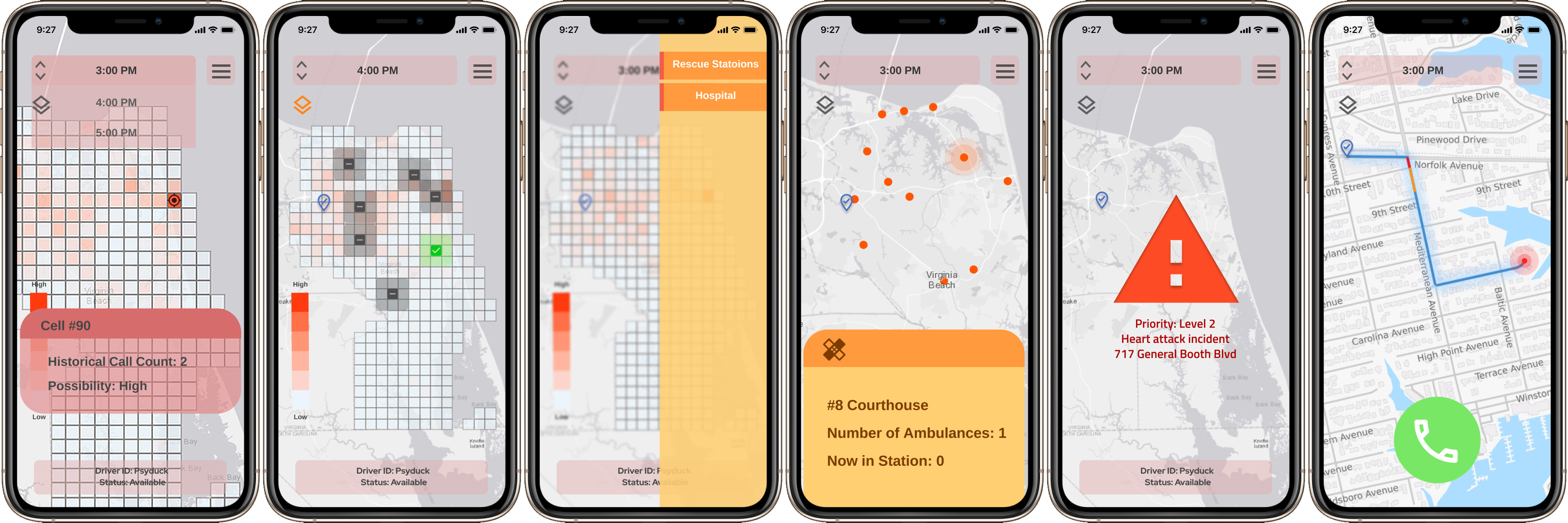
Regional EMS Call Prediction in Virginia Beach |
Presentation and Interface Design
Forecasting temporal and spatial patterns of EMS call in the next few weeks.
Skills used: R, Zero-inflated poisson model, Time and spatial lag, Figma
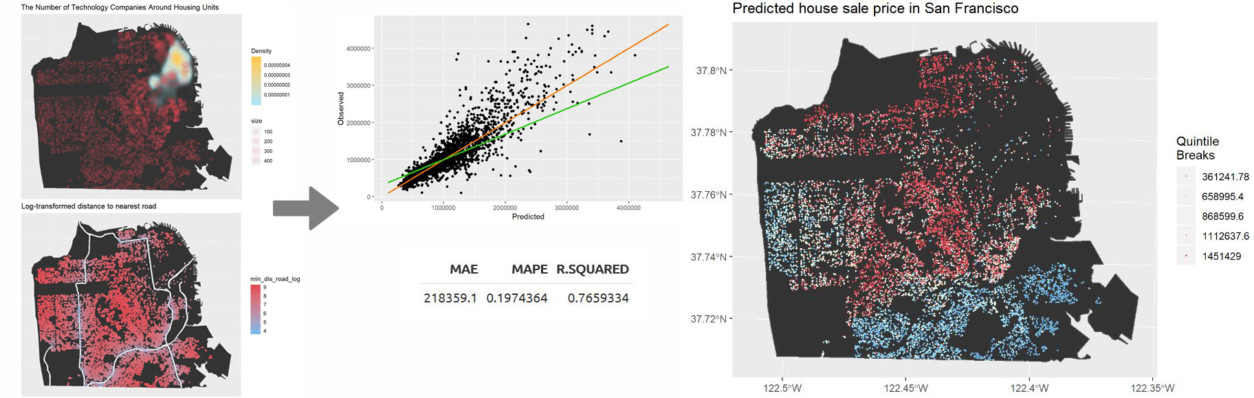
Housing Price Prediction in San Francisco
Predicting San Francisco home price for Zillow to provide local-level insights of marketing trends.
Skills used: R, OLS regression model
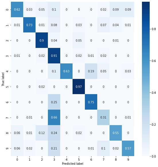
EuroSAT Land Use and Land Cover Classification using Deep Learning
Implementing deep learning models to solve land use identification problem in satellite imaging using a benchmark dataset.
Skills used: Python, Keras, Artificial Neural Network, Convolutional Neural Network
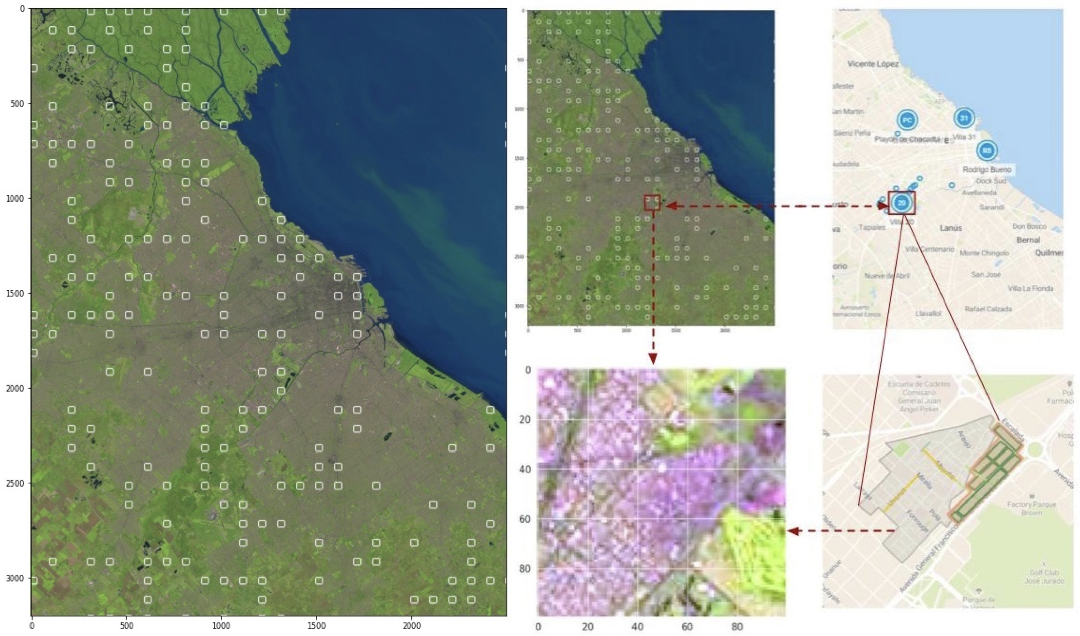
Remote Sensing Based Argentina Slums Identification
Identifying slum areas in the city of Buenos Aires with multi-approach.
Skill used: Python, Machine Learning (Scikit-learn), K-Means, SVM, Deep Learning (Keras), Convolutional Neural Network, ResNet
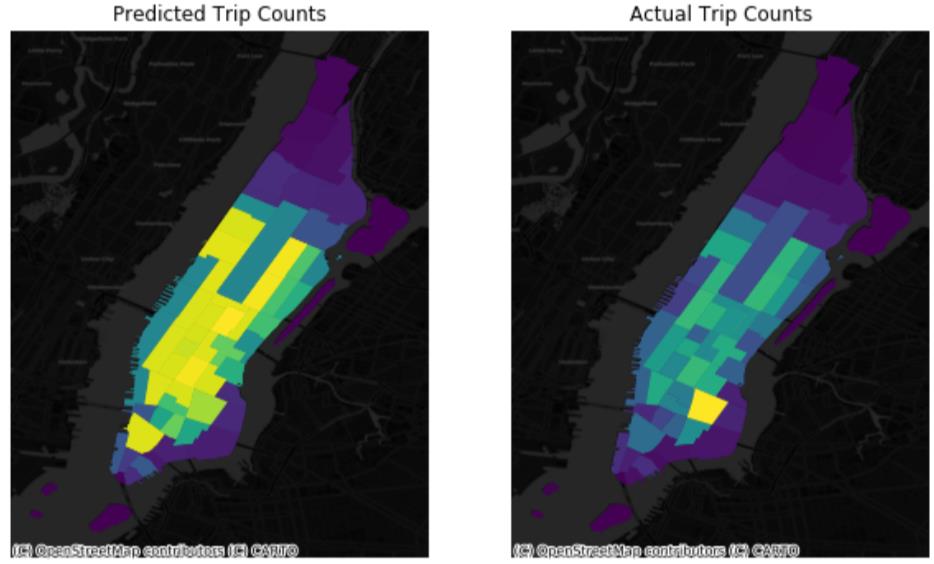
Taxi Data Analysis in New York City
Exploratory analysis and predictive model for taxi demand and supply in Manhattan, New York City.
Skills used: Python, Data visualizaiton (Dash, Panel, Foilum), Clustering analysis and Random forest ML model by Scikit-learn, GitHub Pages
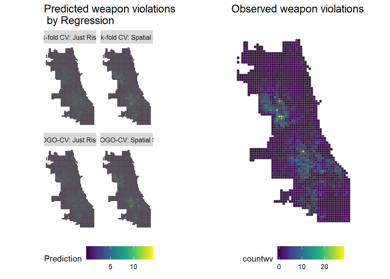
Weapon Violation Prediction in Chicago
Geospatial risk prediction for the case of weapon violaiton in Chicago. Discussing the reporting and selection bias, as well as fairness and recidivism.
Skills used: R, Possion regression model
Web Application and Data Visualization
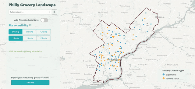
Philly Grocery Locations Dashboard
Distribution and accessibility of grocery locations in Philadelphia.
Skills used: JavaScript, HTML, CSS, Mapbox GL, Turf
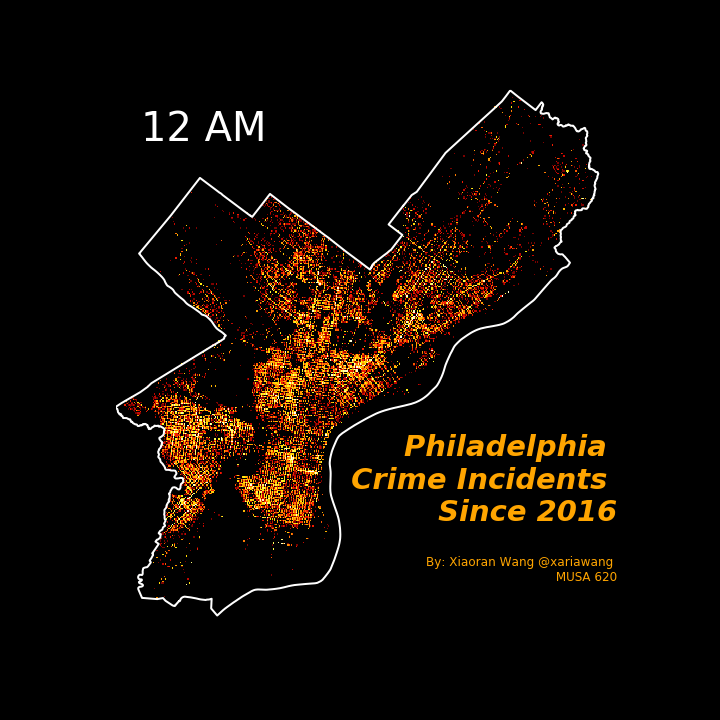
Visualize Philadelphia Crime Incidents
What time of day Philly has the heightest crime rate?
Skills used: Python
GIS and Spatial Analysis
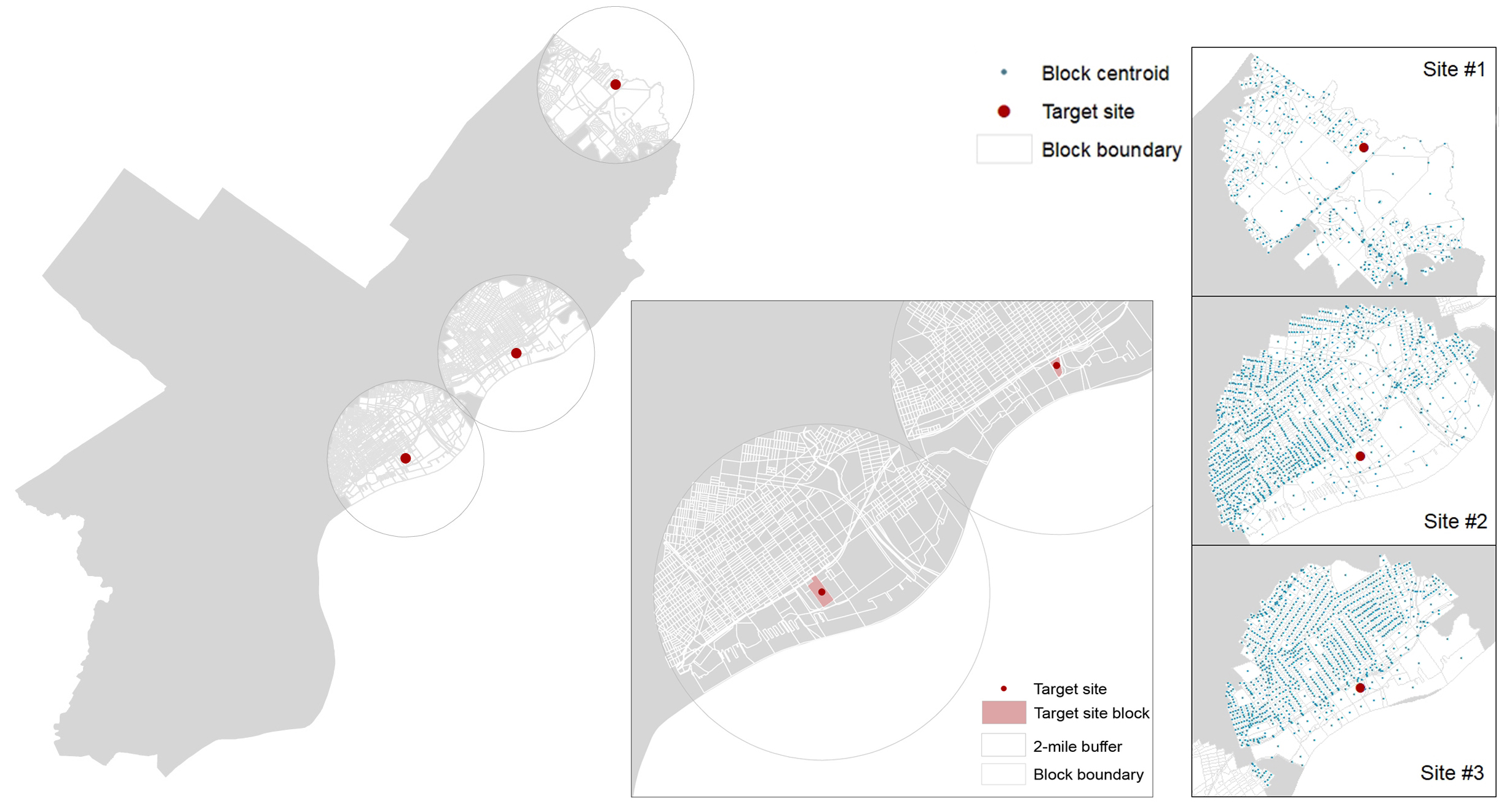
Locating Affordable Grocery Business in Philadelphia
Skills used: ArcMap, Python, Adobe Illustrator
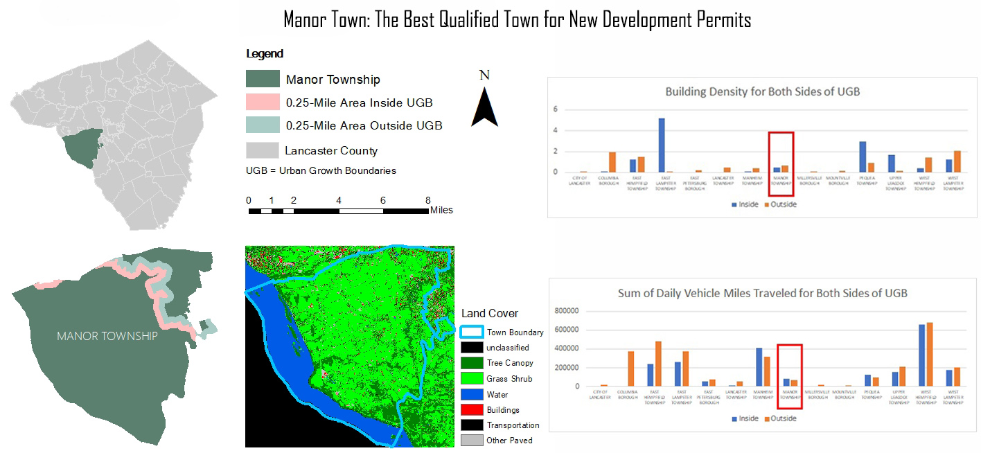
Lancaster County Urban Growths
ArcMap Script Tool Development
ArcGIS Pro Stylization Tool Development
Skills used: Python, C#, ArcGIS Pro SDK, ArcMap
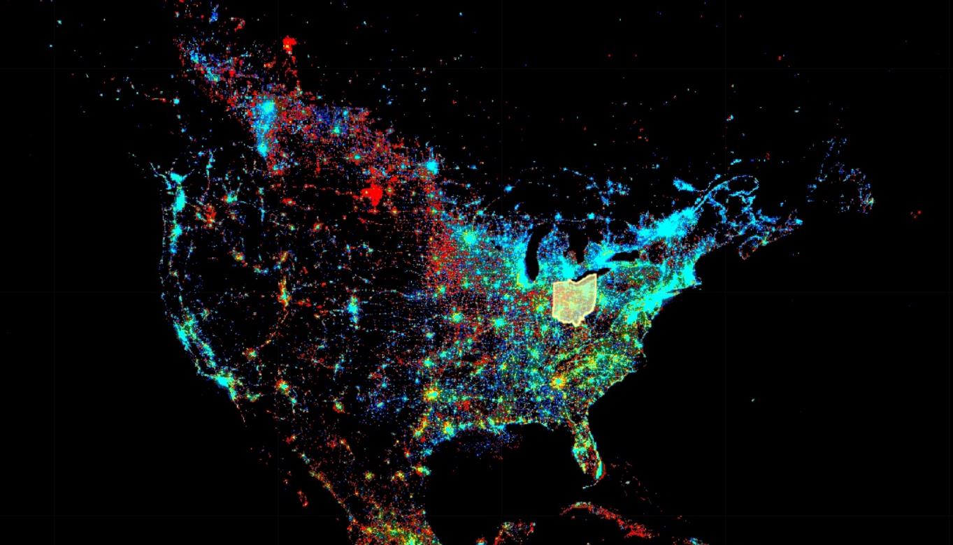
Ohio Population Movements
Skills used: Google Earth Engine, JavaScript
Agent-based Spatial Pattern Modeling for Random motion and Biased Random Motion
The program loads the OSU buildings and pavement GIS data from shapefiles and create NetLogo patches correspondingly. The model picks up a random building as a target for student movement and then generates up to 200 students at buildings (green patches). Student motion can be either random or biased. When the motion is set to be random, a student moves ahead if the patch ahead of him is feasible (the patch exists in the NetLogo world and corresponds to building or pavement), or makes a random left turn if not. When the motion is set to be biased, a student faces towards the target building after every successful move.
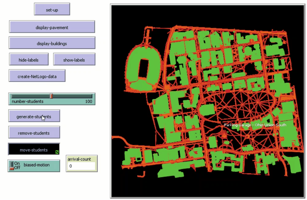
Photo Work

Page template forked from evanca